


Essential General Information
| Aspect | Details |
|---|---|
| Location | Community of Yanama, district of Santa Teresa, province of La Convención, Cusco |
| Distance from Cusco | ~205 km by road to the starting area |
| Site altitude | ~3,040 m.a.s.l. |
| Average park altitude | ~1,500 m.a.s.l. |
| Entrance | Reference ~S/ 60 for foreigners |
| Name meaning | From Aymara “chuqui” (gold) + Quechua “k'iraw” (cradle) → “Cradle of Gold” |
Strategic Inca connection: Choquequirao served as a node linking Pisac and Machu Picchu toward the Amazon, acting as a key hub for controlling the Antisuyo.
Complete History and Context
🏛️ Pre-Inca Period
The earliest settlements in the region belonged to ethnic groups such as the Antis, Manaries, and Pilcozones. Evidence of the Killke regional state (1000–1200 AD) has also been found in several areas of Cusco, Anta, Urubamba, and Vilcabamba.
👑 Inca Period
The construction of Choquequirao is mainly attributed to Túpac Inca Yupanqui, though some studies also consider Pachacútec a possible founder. Its key functions included:
- Antisuyo control: Strategic access to the Amazon to obtain feathers, exotic species, and coca
- Agricultural center: Specialized production of coca, chili peppers, cotton, and medicinal plants
- Ritual and political role: Temples, ushnus, and ceremonial plazas
- Hydraulic engineering: Terrace and irrigation systems to adapt the steep slopes
⚔️ Inca Resistance (1537–1572)
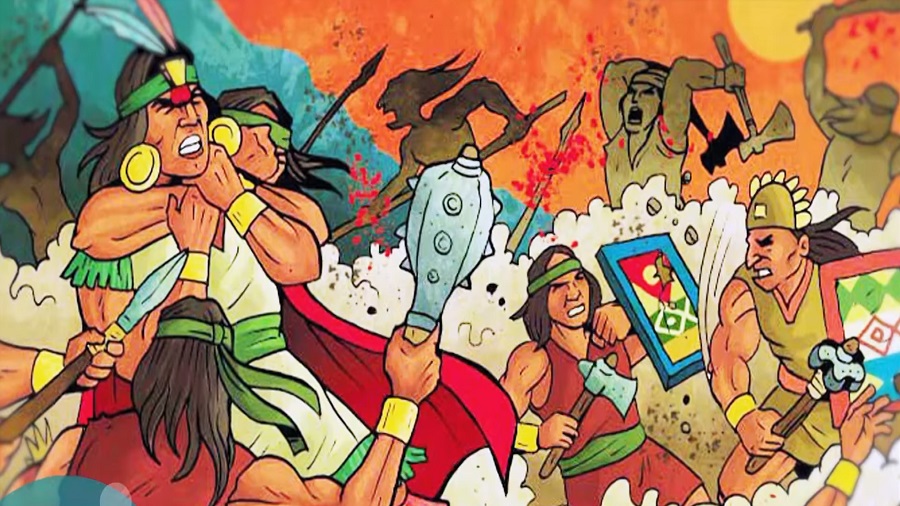
Choquequirao was a crucial bastion during the resistance led by Manco Inca and his successors: Sayri Túpac, Titu Cusi Yupanqui, and Túpac Amaru I. This period was essential for organization, worship, and defense against the Spanish conquest.
Modern recognition: On December 24, 2010, Choquequirao was declared a Regional Conservation Area, recognizing both its exceptional cultural and natural value.
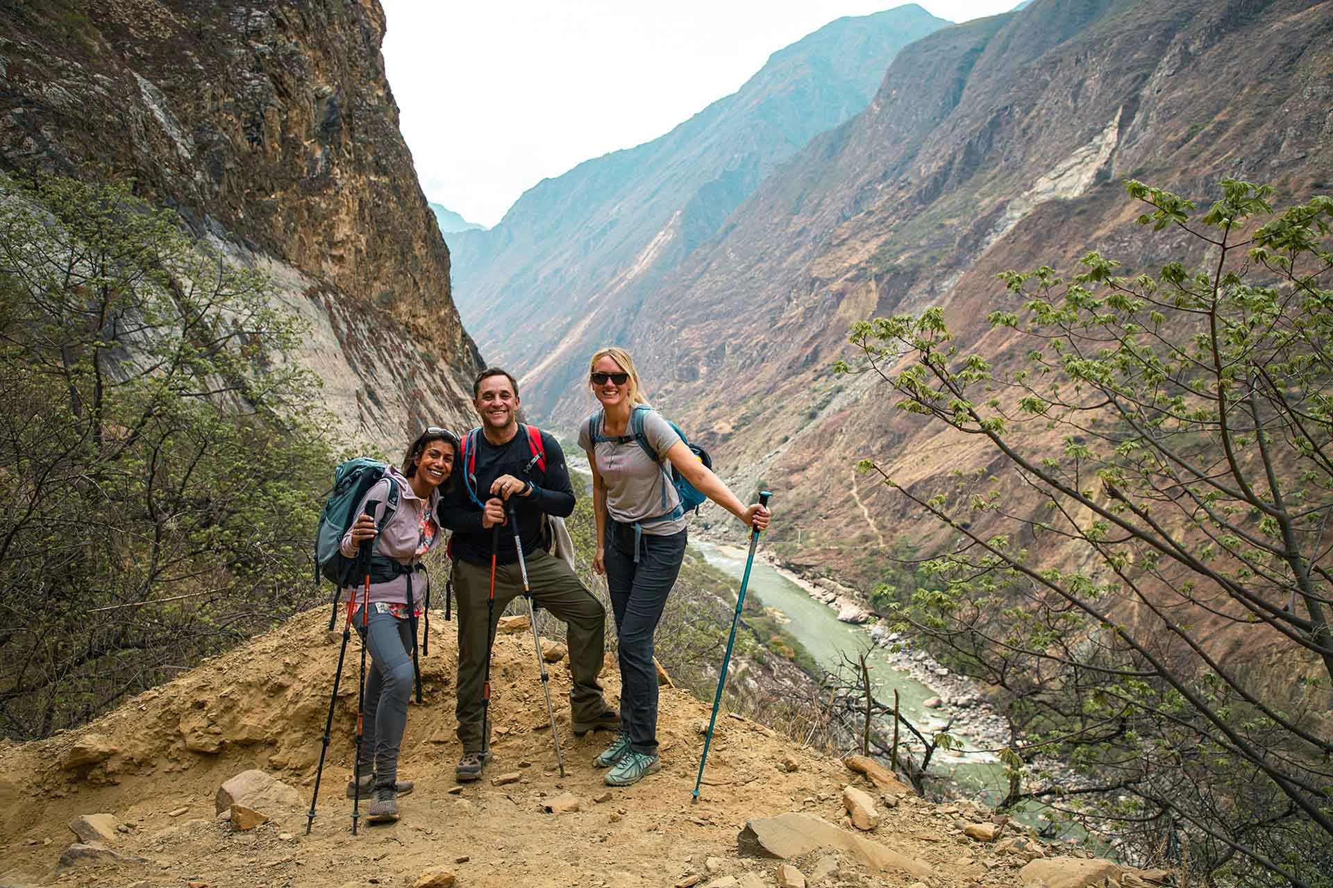
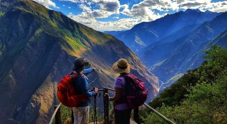
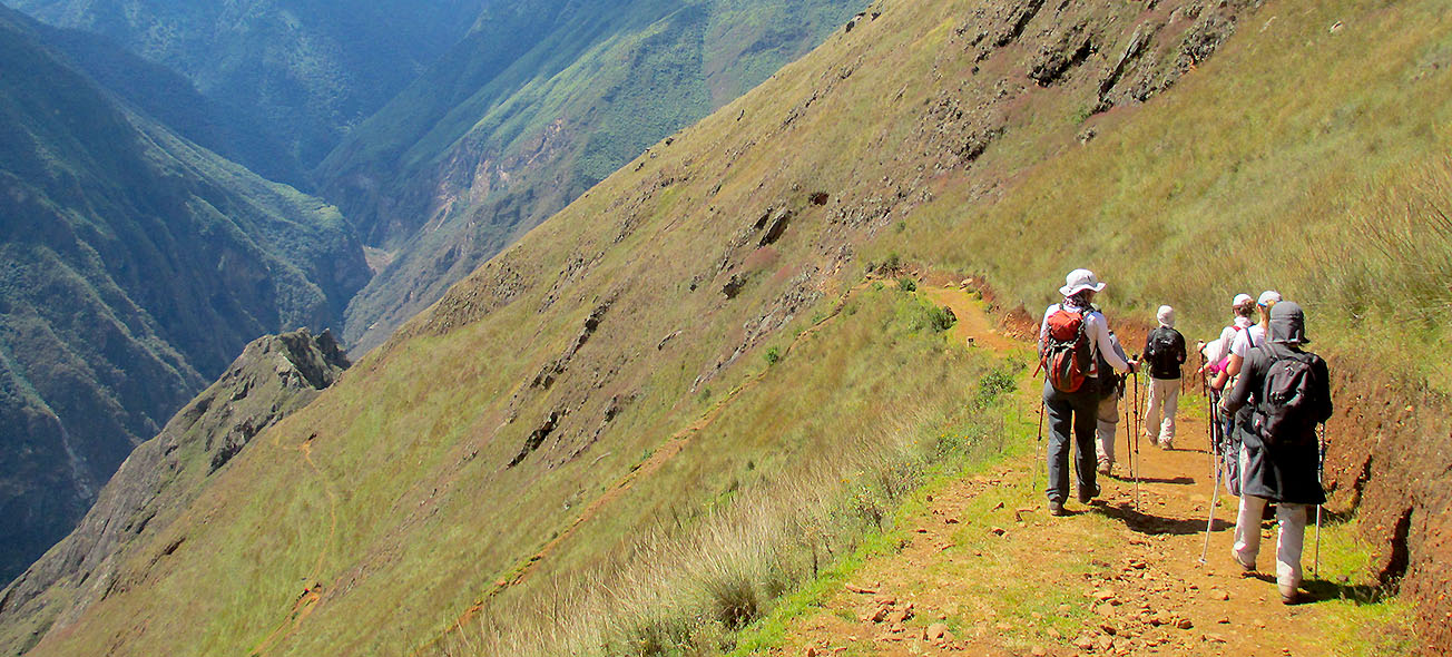
Routes to Get There
Typical start: Capuliyoc with panoramic views of the Apurímac
Features: Mule track trail with steep descents (down to the river and back up)
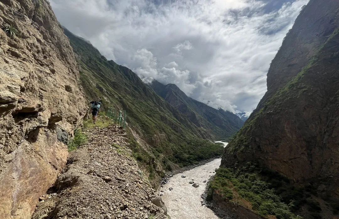
Advantages: Faster and less crowded
Path: Huanipaca → Tambobamba → Kiuñalla → San Ignacio → Playa del Apurímac → pedestrian access to Choquequirao (right bank of the river)
Difficulty: Narrow and demanding, crossing the Salkantay and Yanama passes
Recommendation: Only for highly experienced trekkers
The full journey: Starts on the classic route and links via Yanama and Santa Teresa to Machu Picchu
Ideal for: A full Vilcabamba experience
Operational tip: For any route, hiring a specialized agency provides logistical safety (meals, camping gear, mules/horses when needed, treated water) and risk management.
5-Day Classic Trek – Detailed Itinerary
• Departure approx. 4:30 a.m.
• 4 hours by road to Capuliyoc + 6 hours of descent into the canyon
• Camp: Chikiska
• Intense 8-hour climb with spectacular views of the Apurímac
• Camp: Marampata (viewpoints towards the mountain range)
• Approx. 2-hour hike to the archaeological site
• Full guided tour of temples, terraces, and archaeological sectors
• Overnight return at Marampata
• Prolonged descent followed by moderate ascent
• Camp: Coca Masana
• Final ascent of approx. 4 hours
• Pachamanca lunch (optional/traditional) and return to Cusco
Difficulty level: Moderate–challenging due to steep ascents/descents and heat in the lower areas. Even with trekking experience, legs work hard.
Tip: If traveling with a group/family, the 5D/4N format allows you to better enjoy the site; the 4D/3N is more intense.
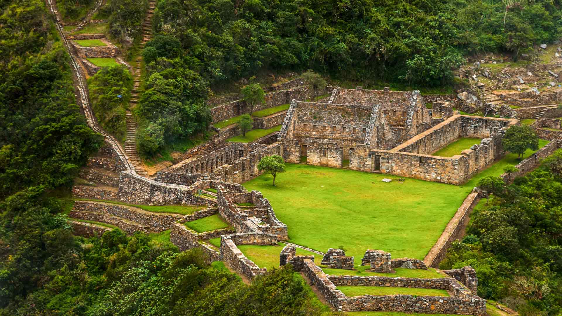
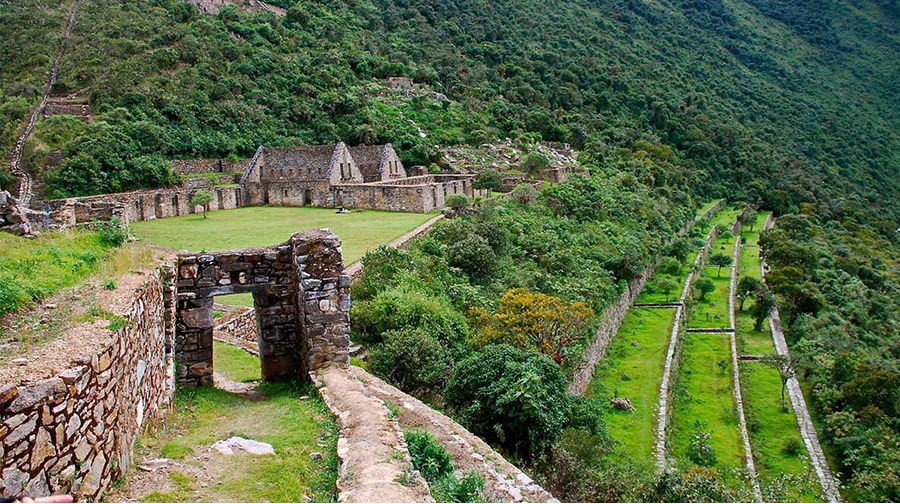
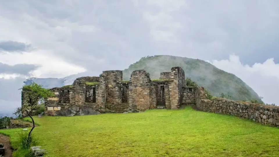
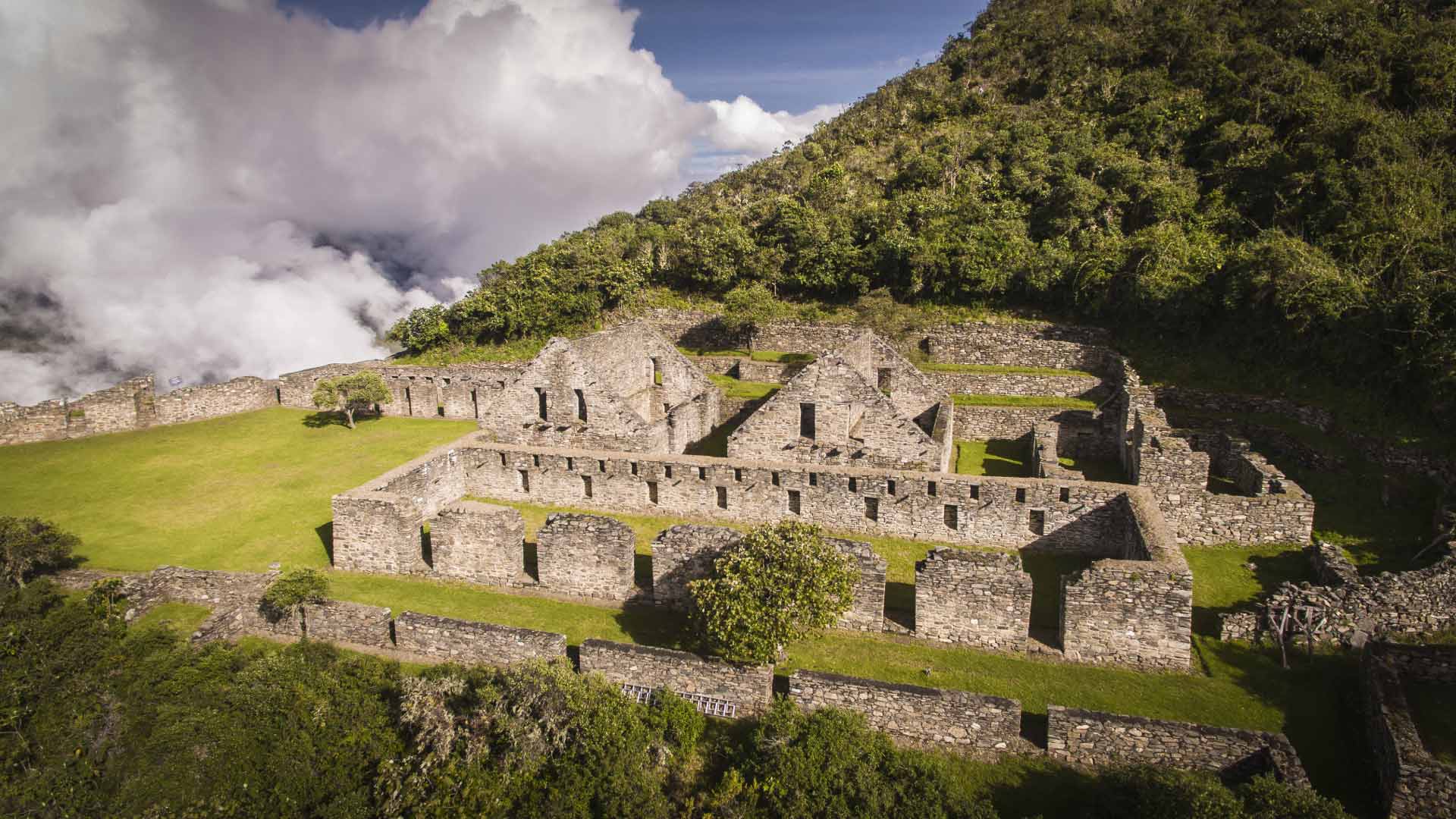
What to See in Choquequirao - Archaeological Sectors
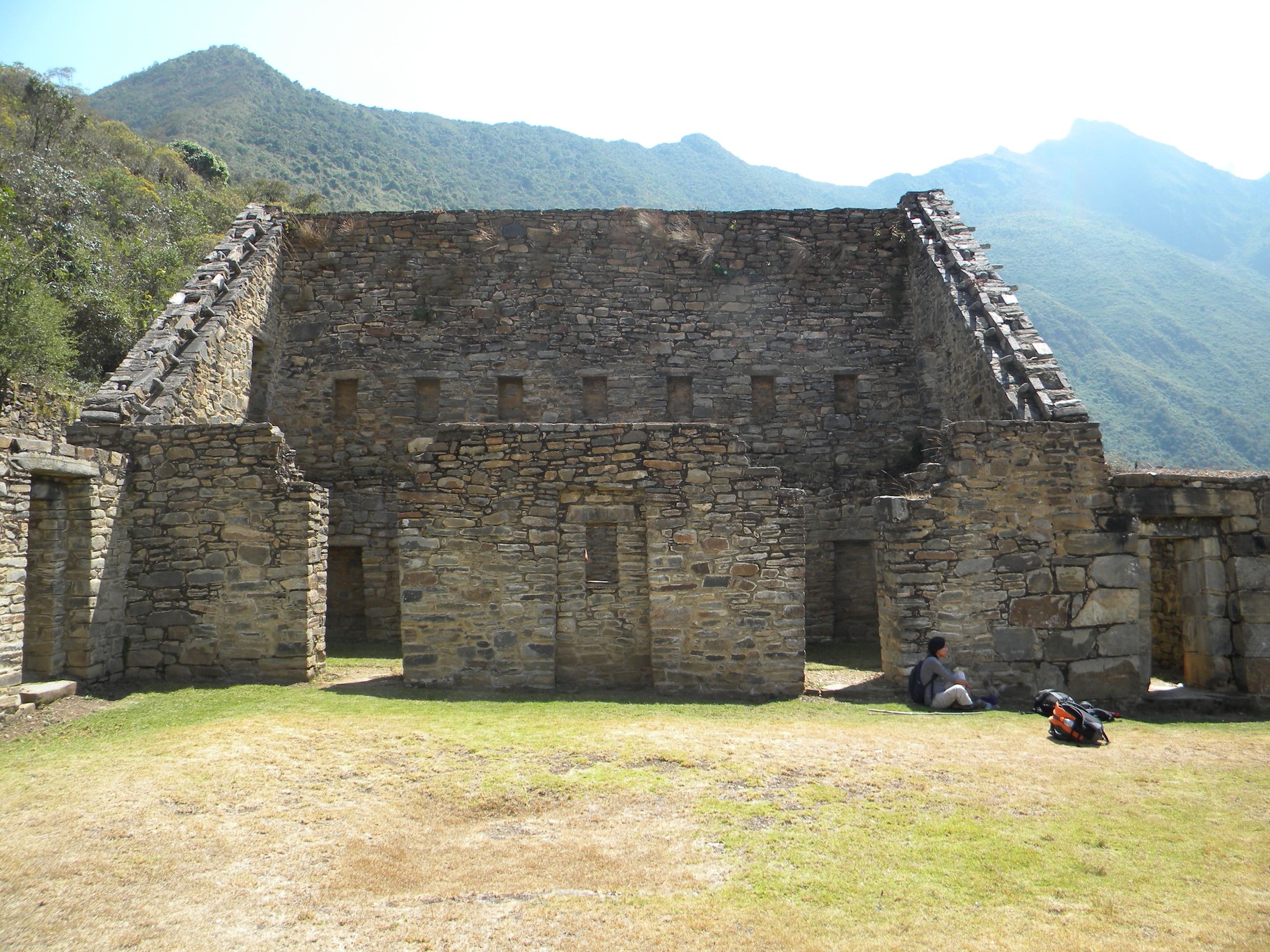
🏛️ Hanan Temple (Upper Zone)
The upper zone of Choquequirao houses temples, sacred enclosures, water channels, and an impressive stepped waterfall. It is divided into two subsectors with corridors, terraces, and continuous buildings that demonstrate Inca urban planning.
📦 Qolqas (Storehouses)
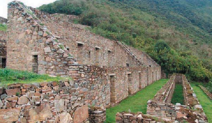
Large buildings used for storage, some with two stories and integrated ventilation systems for optimal food preservation. These structures showcase the sophisticated Inca logistics for supply management.
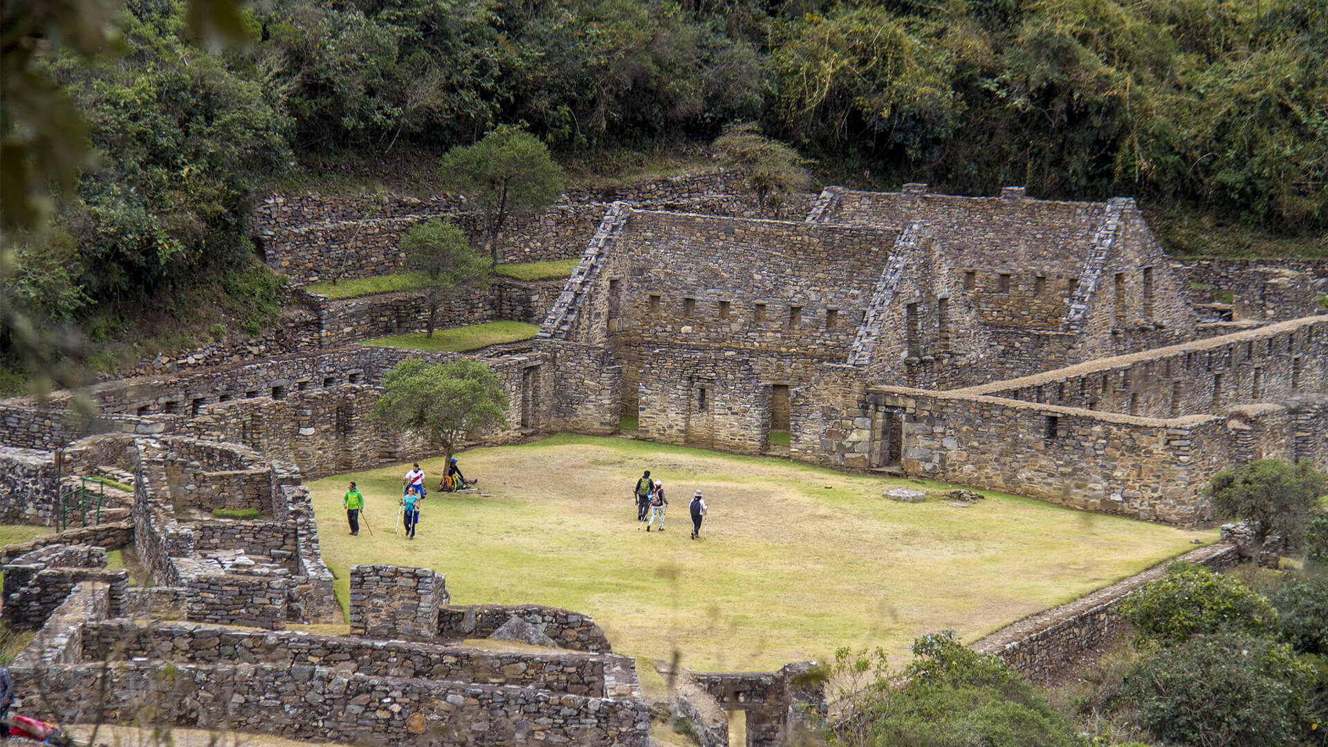
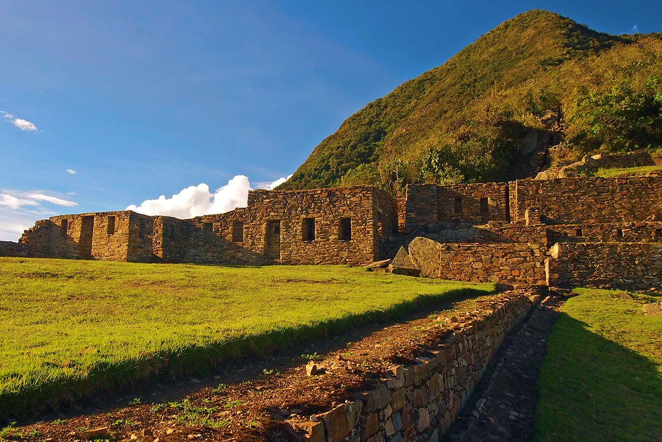
🏛️ Main Plaza (Haucaypata)
The ceremonial and urban core of Choquequirao consists of 9 main buildings. It includes two-level Kallankas (residences and public functions), the Sunturwasi, and the Main Temple. Four terraces form a sacred enclosure used for important ceremonies.
🚪 The Portals
Four double-jamb trapezoidal portals located south of the main plaza. This sector is considered the “Monument consecrated to the ancestors,” where malkis (illustrious mummies) were likely kept during ritual ceremonies.
⭐ Ushnu (Ceremonial Platform)
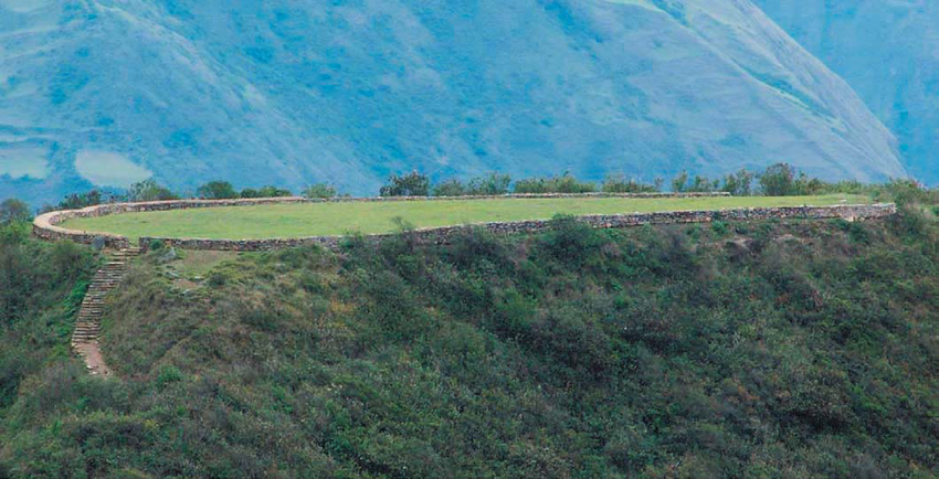
Located on top of a hill, it has a perimeter wall of ~147 meters and three horseshoe-shaped terraces. It was the center for rituals, libations, and astronomical observations with important political and military significance. It offers exceptional views of the Apurímac Canyon.
🏠 House of the Priests
A complex divided into two main areas with five retaining walls and two rectangular buildings. It was a restricted space intended for the preparation of ritual officiants and sacred ceremonies.
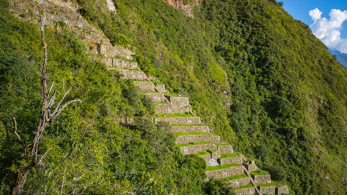
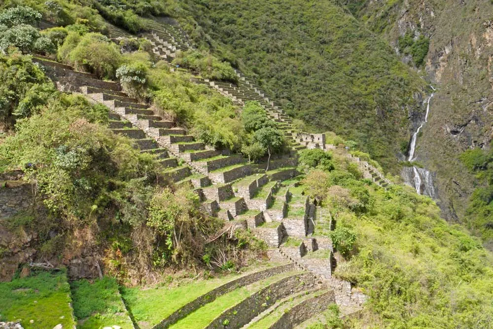
🌾 Sacred Terraces
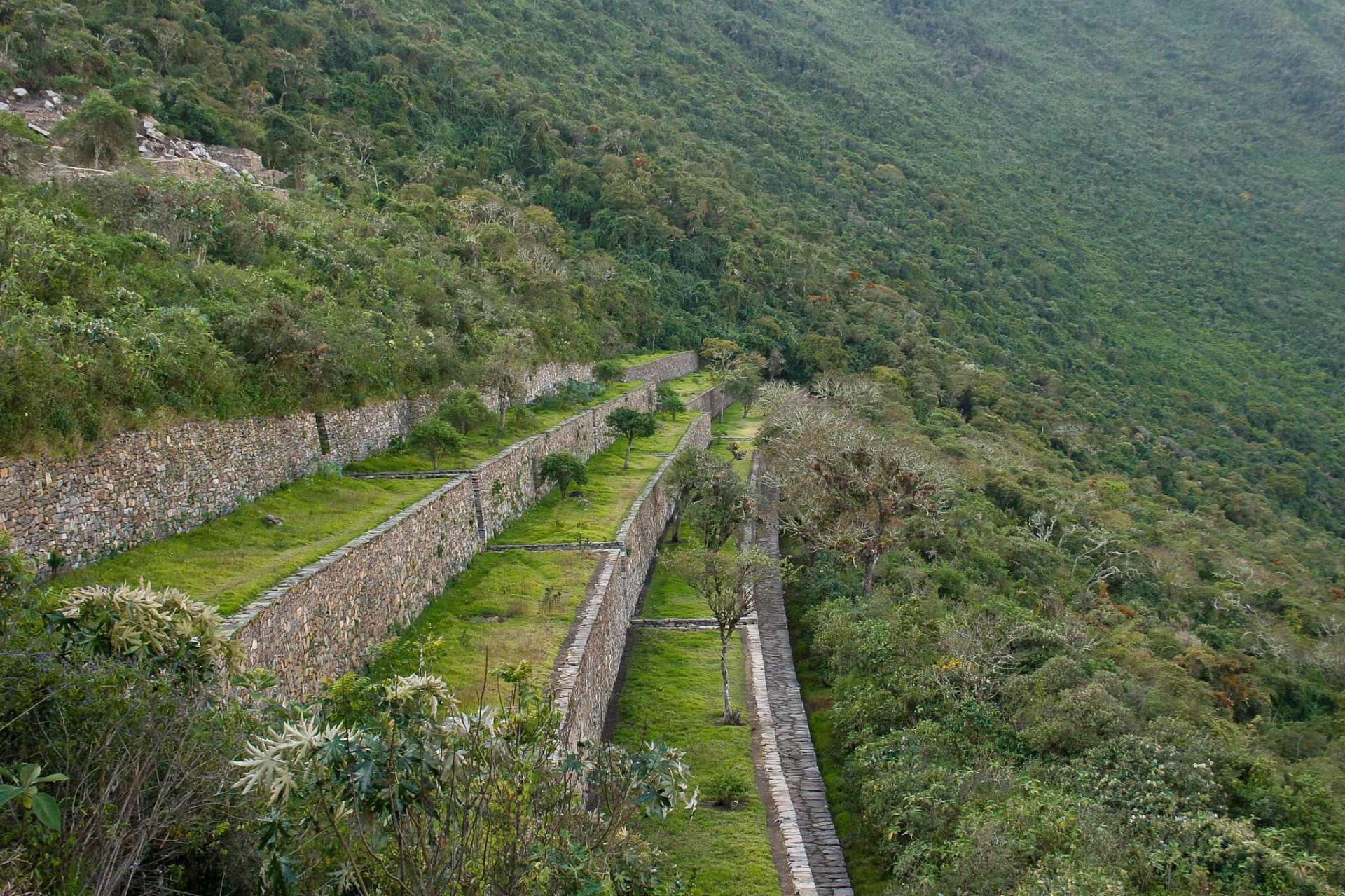
An impressive set of terraces distributed in five subsectors with a concave layout to the southeast and northeast. The longest terrace reaches about 116 meters, showcasing the Inca mastery in agricultural engineering.
🦙 Llama Terraces (Discovered in 2002)
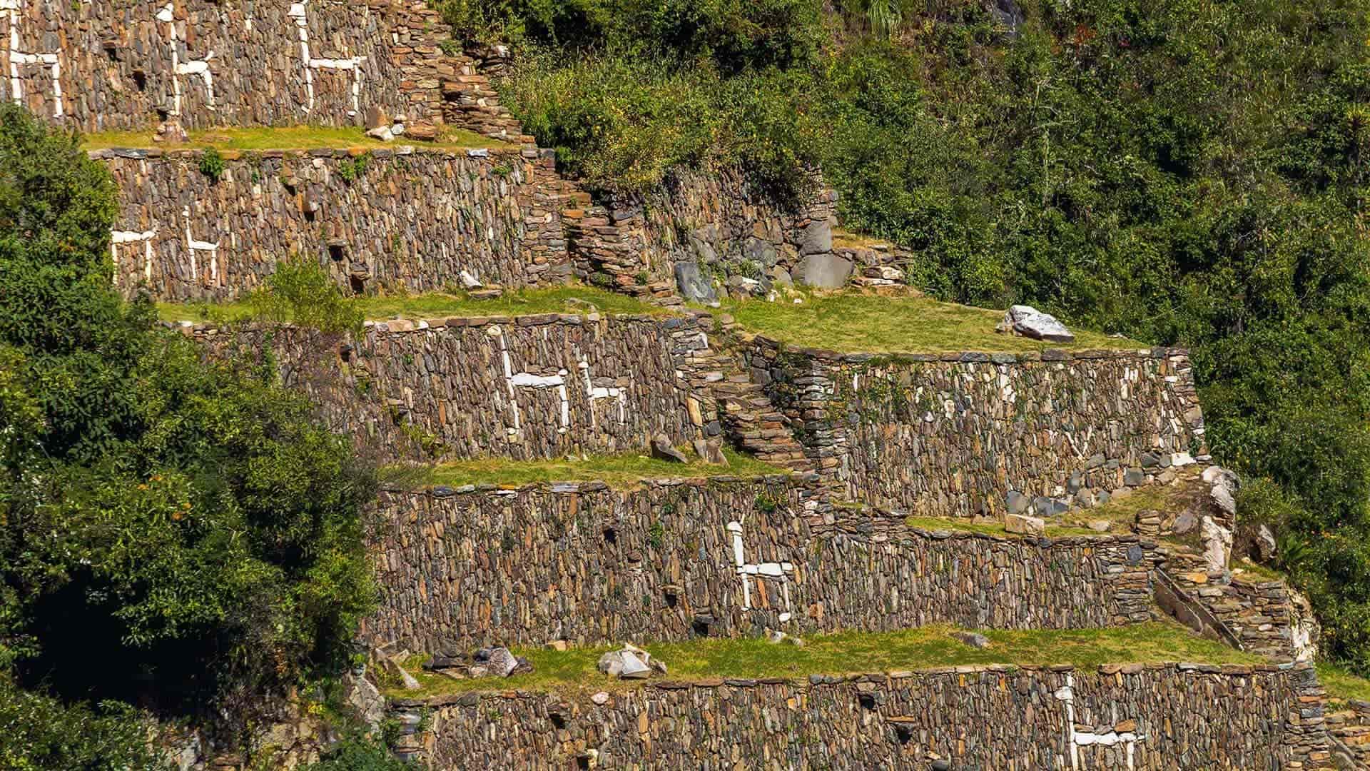
Located north of the site, they include 16 levels of very steep terraces with figures of camelids, humans, and geometric patterns embedded in white limestone. This sector requires extra caution when descending due to its steepness.
🏔️ Paraqtepata
A group of 18 terraces arranged vertically on the slope, organized into 5 agricultural sections with irrigation systems. Visible from long distances, they form one of the site’s most photogenic landscapes.
🌊 Phaqchayoq
The largest set of terraces in all of Choquequirao, distributed across nine groups. Includes a central promontory with three buildings: one with four entrances and another square-shaped with two entrances. It features a sophisticated irrigation canal system.
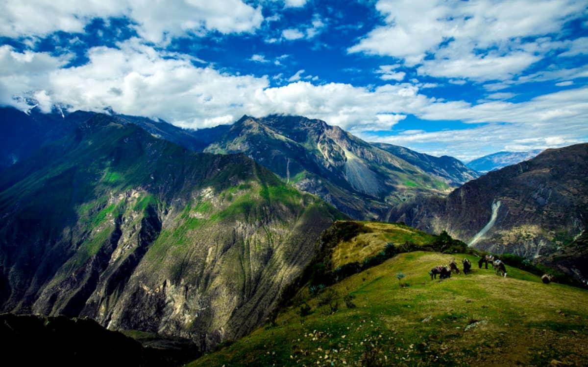
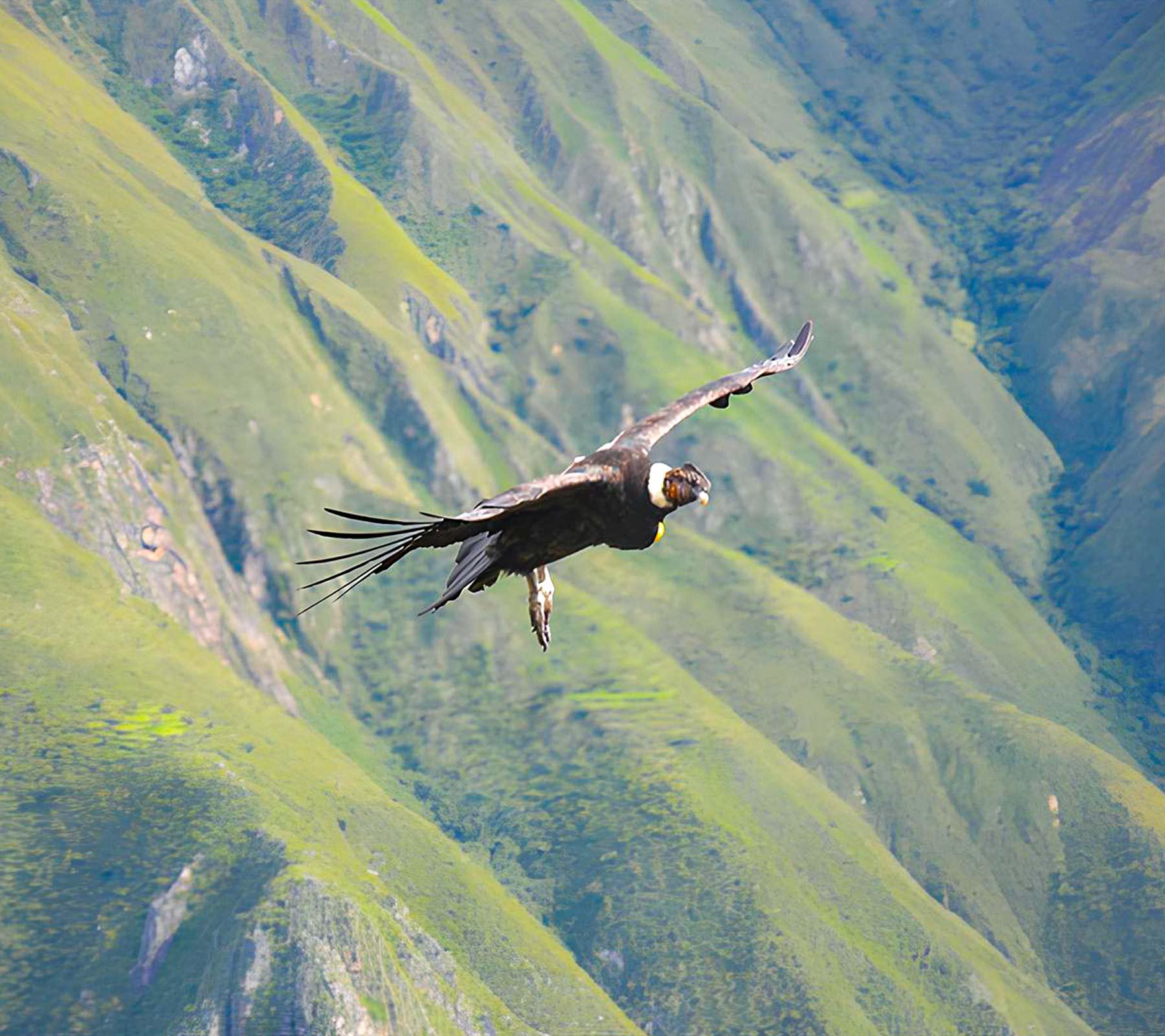
🦅 Wildlife spotting: From Choquequirao’s viewpoints you can spot the majestic Andean condor soaring above the Apurímac Canyon cliffs, while enjoying 360° panoramic views of one of the deepest canyons in the world (~4,690 m deep).
Exceptional Biodiversity
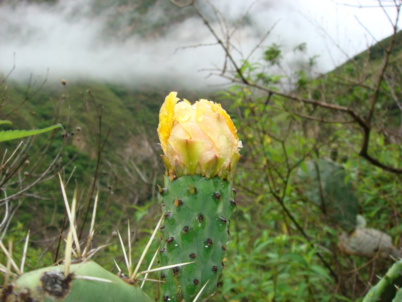
🏞️ Ecosystems (8 different types)
Choquequirao encompasses an extraordinary diversity of ecosystems, ranging from glaciers and Andean scrublands to montane yunga forests, creating a unique natural mosaic in the Andes.
🌺 Featured Flora
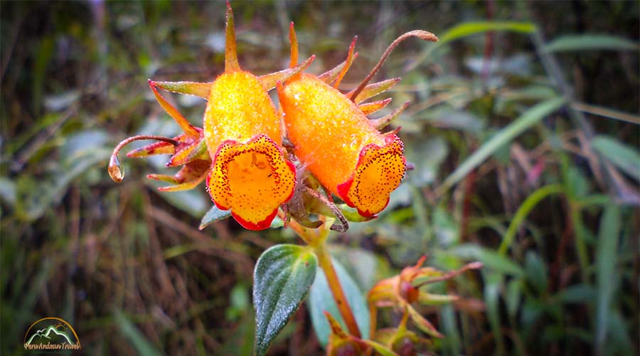
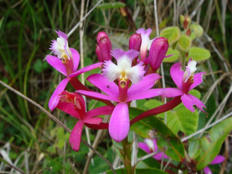
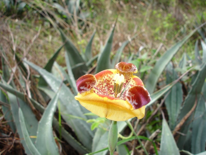
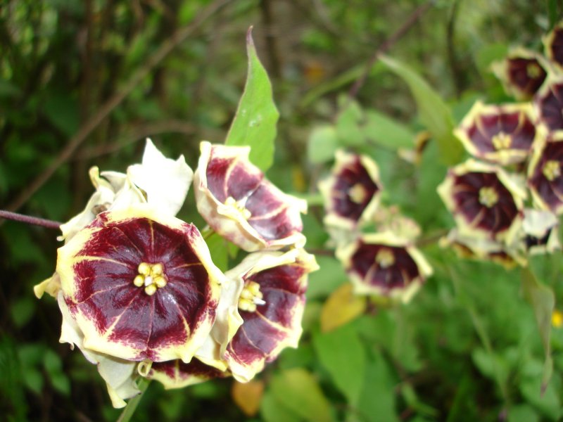
- ~196 orchid species: Bletia catenulata, Cyrtochilum aureum ("Zaza-Zaza"), "Waqanki" (Masdevallia veitchiana)
- ~482 tree species: Kiswar (Buddleja coriacea), queñoa (Polylepis tomentella), achupalla (Puya herrerae), sankayo/warako (Echinopsis maximiliana)
🦌 Featured Fauna
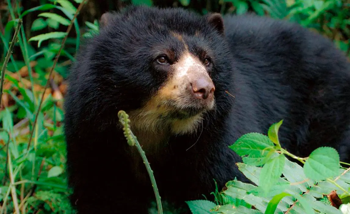
| Group | Species | Key Examples |
|---|---|---|
| Mammals | ~46 | Spectacled bear, Andean fox, white-tailed deer |
| Birds | ~314 | Andean condor, endemic hummingbirds |
| Amphibians | ~12 | Species adapted to extreme altitudes |
| Arthropods | ~50 spiders, ~10 harvestmen, ~3 scorpions | Specialized mountain fauna |
| Insects | ~97 beetles, ~91 butterflies (day), ~41 (night) | Great diversity of pollinators |
Observation tip: Bring binoculars for a better wildlife experience and always respect the distance from animals. Do not feed the wildlife.
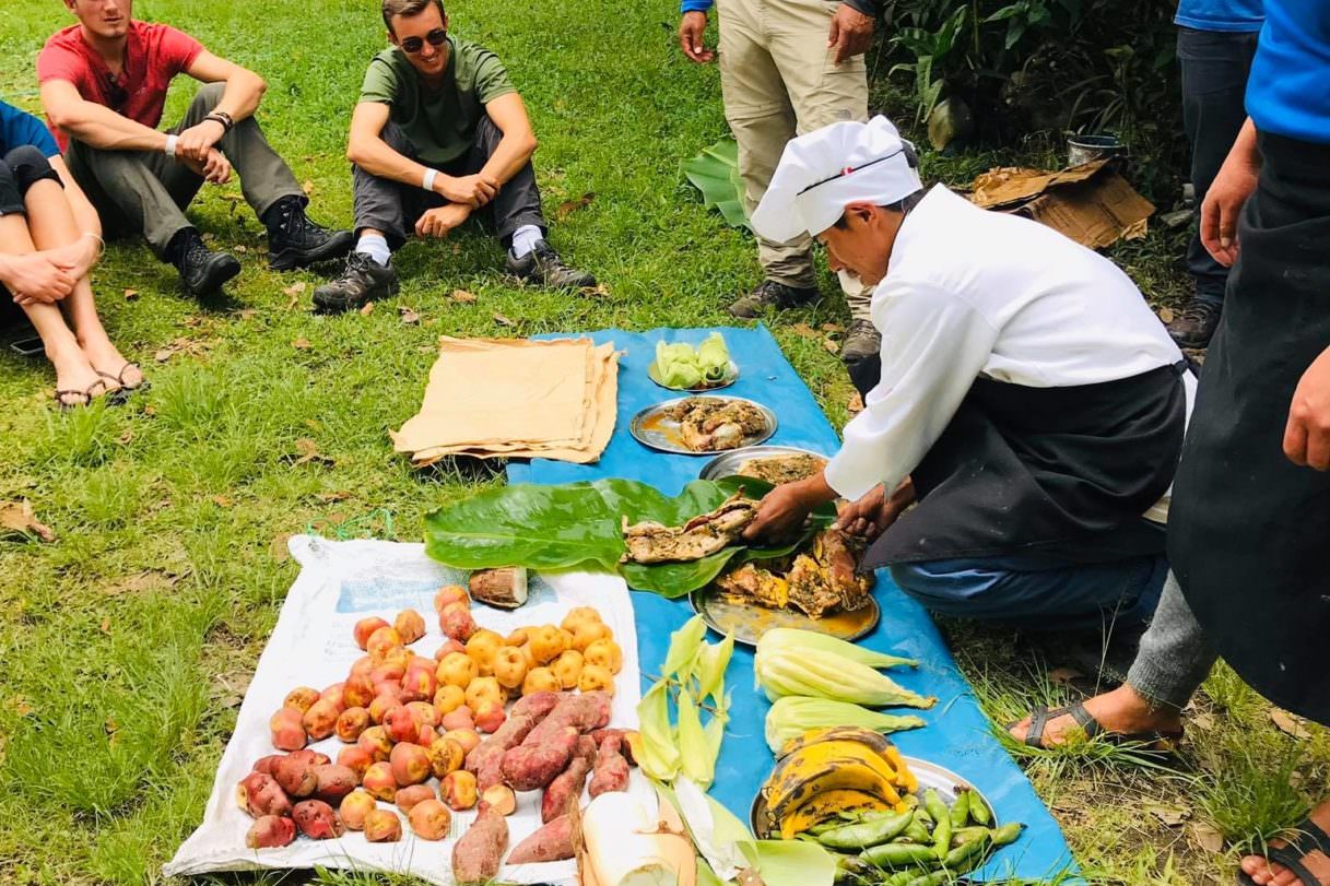
Gastronomy and Traditional Drinks
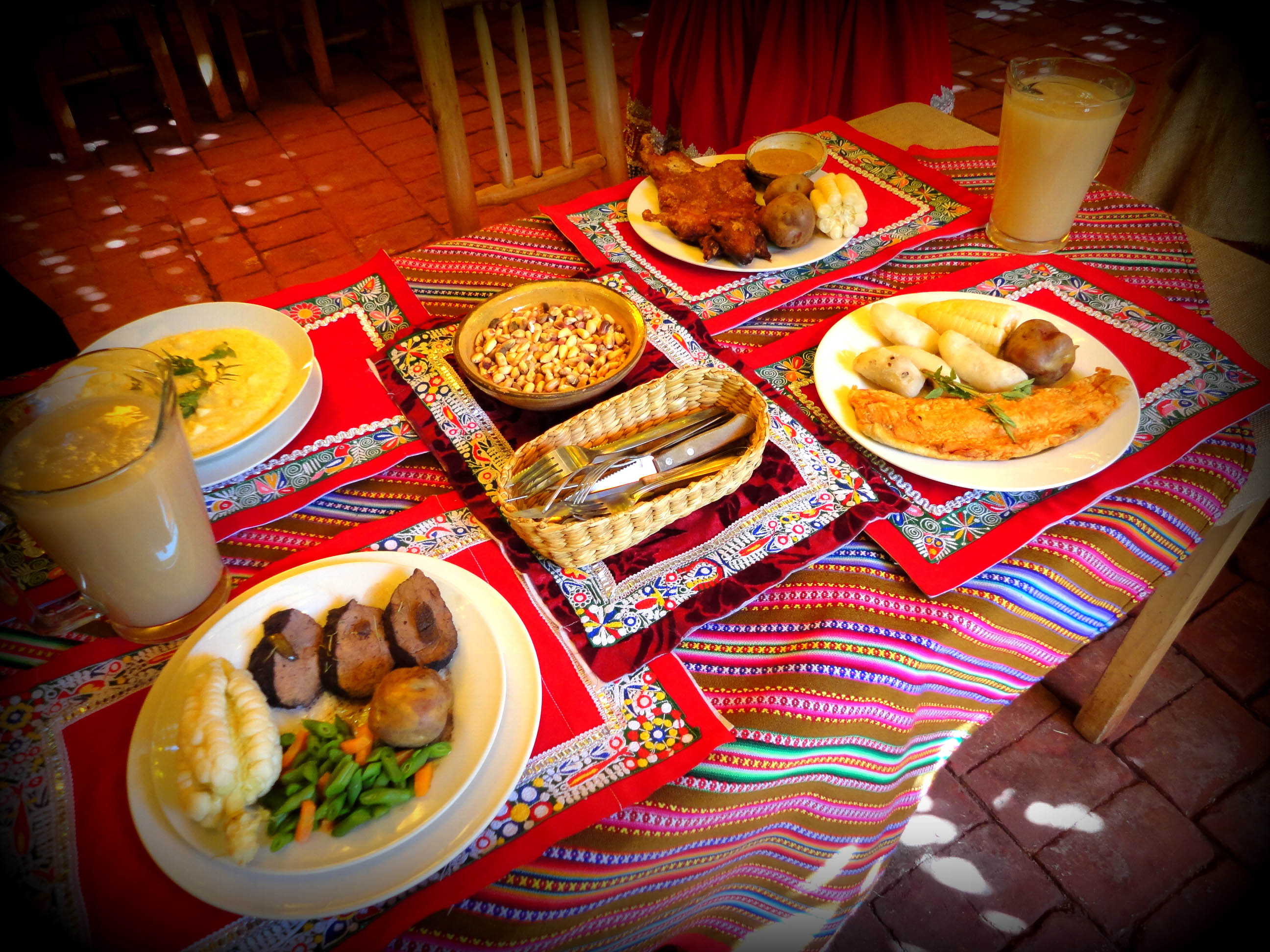
🥘 Typical Dishes Included in Tours
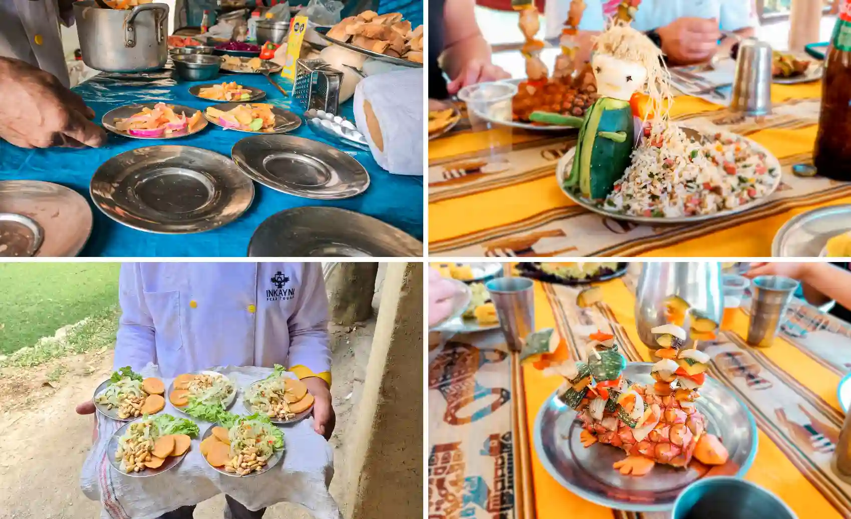
- Ceviche: Peruvian gastronomic emblem
- Pachamanca: Meat and tubers cooked in an earth oven with hot stones
- Cuy (guinea pig): Prepared as pepián, cuy chactado (fried and pressed), or stuffed cuy
- Pork chicharrón: Regional specialty
🍺 Traditional Drinks
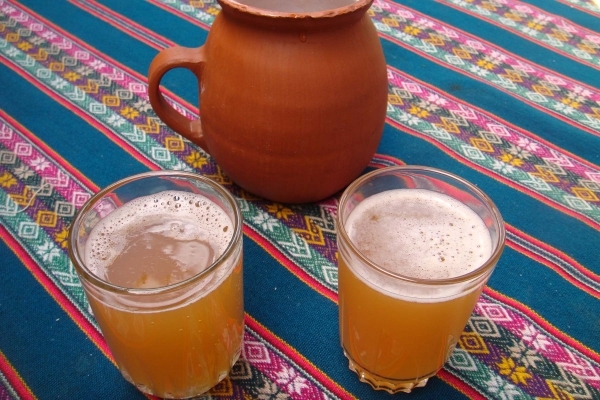
An ancestral drink with Inca legend: it is said Túpac Yupanqui discovered it when stored corn fermented naturally. Today it remains a traditional artisanal preparation.
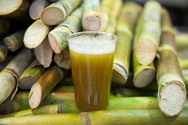
A macerated/fermented sugarcane juice, sweet and amber-colored. Refreshing and energizing.
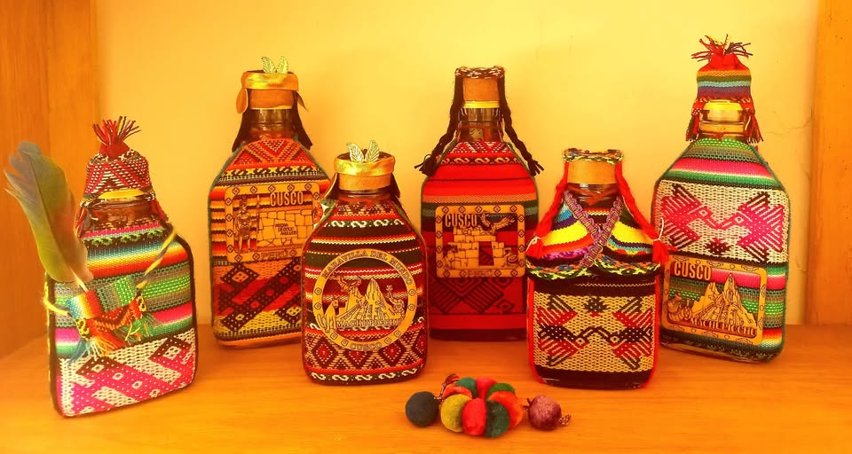
A sugarcane distillate with green anise (may include star anise and fennel). A traditional digestif of the region.
Practical Tips and Recommended Gear
🎯 Minimum Recommended Gear
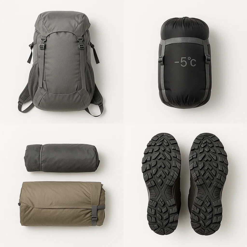
• Backpack 25–30L (light pack)
• Sleeping bag (comfort ~-5°C)
• Rainproof tent
• Trekking shoes with grippy soles

• Hat and UV sunglasses
• Sunscreen
• Trekking poles
• Insect repellent

• Complete first aid kit (bandages, painkillers)
• Rehydration salts
• Water and energy snacks
• Purification system if going independently

• Binoculars for spotting
• Camera with extra batteries
• Headlamp
• Waterproof bags
🛡️ Safety and Ethics
Physical preparation: Do prior acclimatization (1–2 days in Cusco/Sacred Valley) before the trek.
Respect heritage: Stay on marked trails, do not climb archaeological walls, do not touch fragile stones.
Conservation: Do not pick plants or flowers, carry all your trash back.
Weather: Stay informed about the weather and Apurímac River conditions, especially during the rainy season.
💰 Costs and Logistics
Typical guided tours range from US$ 500–1,200 depending on inclusions (equipment, pack animals, full meals, specialized guide). You can also go independently, but consider logistics, travel insurance, and emergency time.
Climate and Best Time to Visit
Choquequirao features an Andean–cloud forest regime with abrupt weather changes caused by an elevation difference of approximately 1,500 meters.
| Season | Characteristics | Recommendation |
|---|---|---|
| Dry (April–October) | Temperate to warm, clear skies | ✅ IDEAL – Best conditions |
| Rainy (December–March) | Humidity, fog, slippery trails | ⚠️ Higher difficulty – Advanced experience required |
Typical temperature range:
🌞 Day: ~25°C
🌙 Night: ~4°C
📊 Average: ~14°C
Nearby Places to Complement Your Route
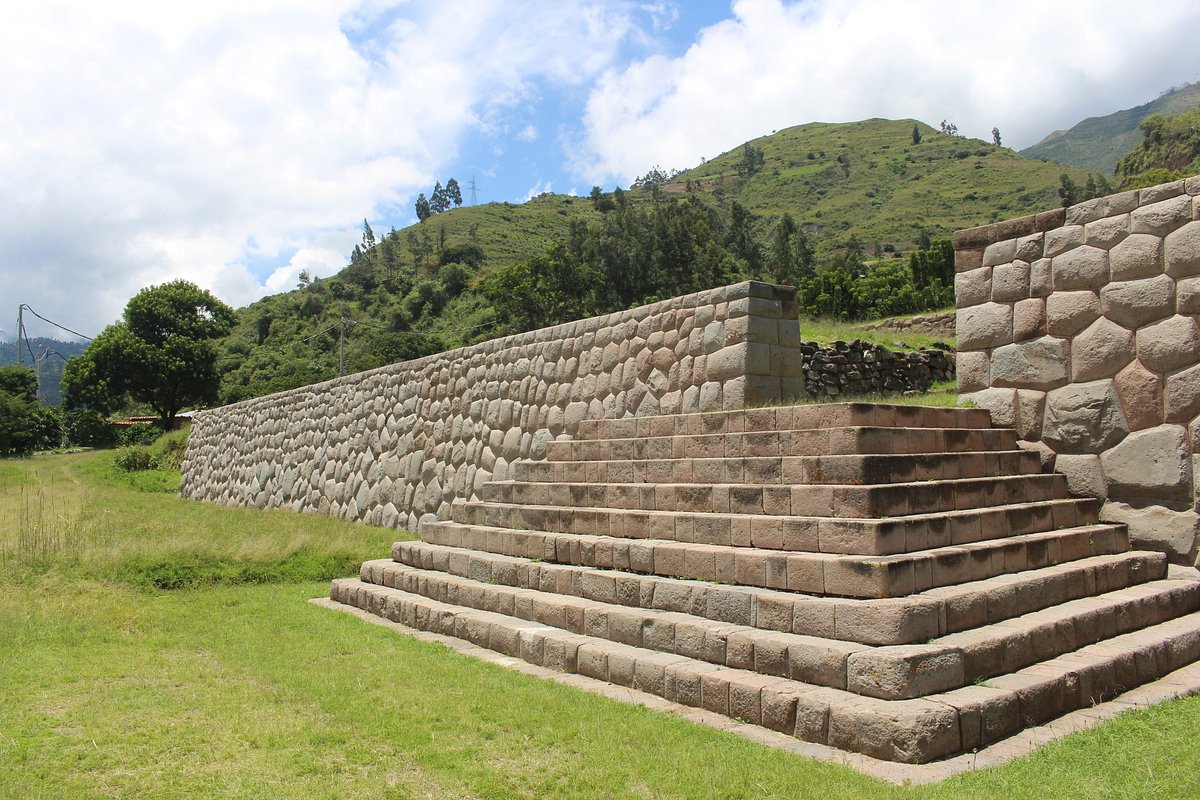
Archaeological complex built over an ancient ushnu with polygonal walls of extraordinary technical precision.
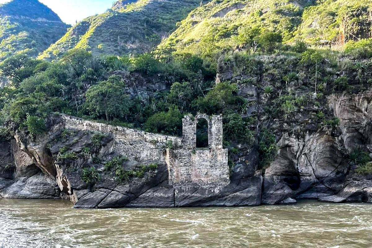
An unfinished colonial bridge on the Cusco–Apurímac border with Inca remains, part of the historic Qhapaq Ñan.
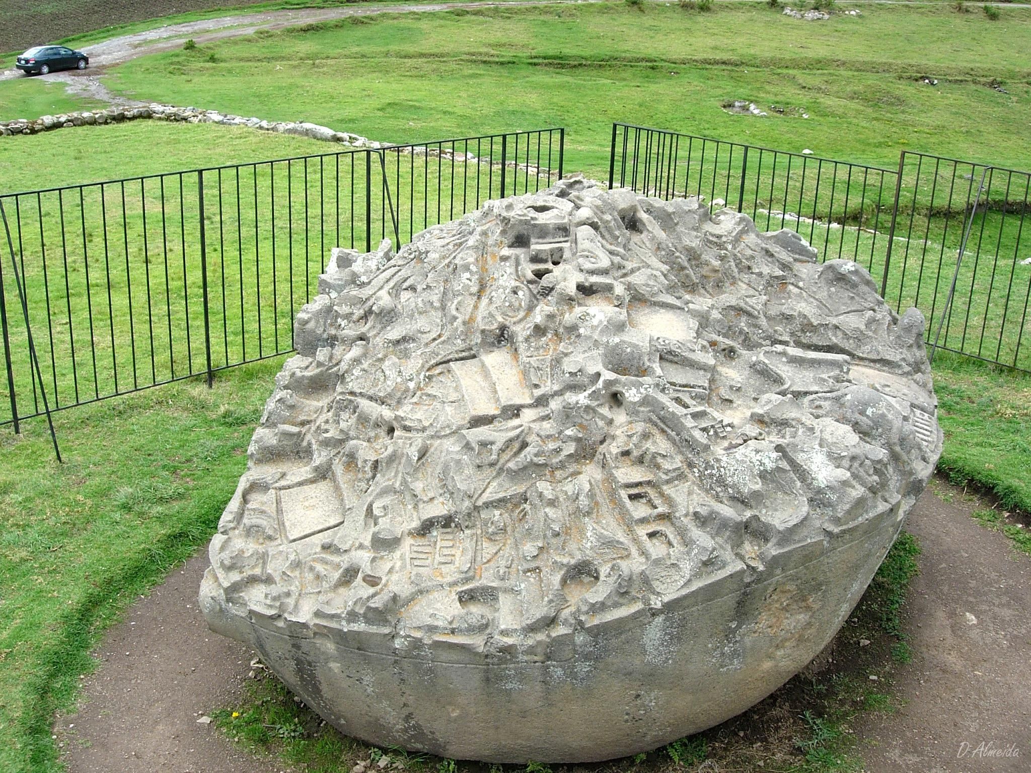
Sacred monolith of ~2.5m with over 200 carved figures of animals and geographic miniatures. Includes additional monoliths in nearby enclosures.
Frequently Asked Questions
Reference: S/ 60 for foreigners. We recommend checking for updates before your trip.
Fast: Flight to Cusco + road to Cachora/Capuliyoc
By land: Bus to Abancay/Cusco + road connection
Road to Cachora/Capuliyoc (~4h) + trek depending on chosen route
Yes, but it requires mountain experience, logistical capacity, and excellent physical condition.
Packages range from US$ 500–1,200 depending on included services (equipment, pack animals, meals, guide).
Moderate–high: steep slopes, heat in lower areas, irregular terrain.
It was known ancestrally. Modern research has systematized its study and conservation.
Absolutely! Exceptional heritage, low tourist massification, and world-class landscapes.
🌟 A Transformative Journey
Choquequirao is an experience that blends physical effort with spiritual reward: trails that challenge you, terraces that narrate Inca genius, views that captivate the soul, and camp nights under a pristine starry sky.
Those who reach this site do not simply visit archaeological ruins—they live an authentic chapter of the Tahuantinsuyo, in perfect harmony with the sacred mountain and the ancestral forest.
🦙 Every step towards Choquequirao is a step towards our deepest roots. 🏔️